
Page 46 - การบรรยายสรุปสภาพอากาศบริเวณสนามบินและเส้นทาง (ภาษาอังกฤษ)
P. 46
ู
รปที่ 7
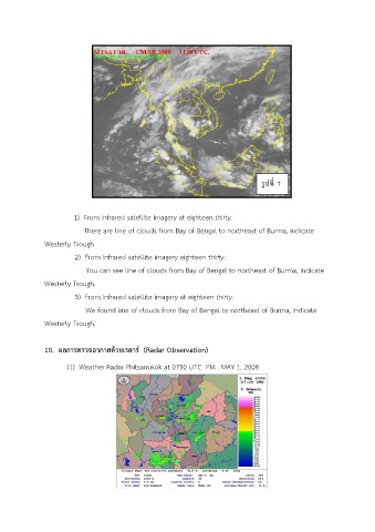
1) From infrared satellite imagery at eighteen thirty.
There are line of clouds from Bay of Bengal to northeast of Burma, indicate
Westerly Trough
2) From infrared satellite imagery eighteen thirty.
You can see line of clouds from Bay of Bengal to northeast of Burma, indicate
Westerly Trough.
3) From infrared satellite imagery at eighteen thirty.
We found line of clouds from Bay of Bengal to northeast of Burma, indicate
Westerly Trough.
10. ผลการตรวจอากาศดวยเรดาร์ (Radar Observation)
้
(1) Weather Radar Phitsanukok at 0730 UTC PM . MAY 1, 2008